Saturday, July 5, 2025

First Baptist Church of Amherst, Nova Scotia

 This will be the final post to this blog for this trip. We are headed home.

Marine Atlantic ferries to and from Newfoundland cross either at night or during the day. The so called short ferry takes about 8 hours. If one embarks on the day ferry they arrive at their destination on the same day they departed. When sailing on the night ferry one arrives the day after they departed. When we crossed over to Newfoundland we were on the night ferry and arrived the next day. On our return trip to Nova Scotia we were originally scheduled for a night ferry but changing our plans ended up with a daytime ferry. That caused us to make a mistake in our itinerary because we arrived in Nova Scotia on the same day we left Newfoundland. Traveling in the US on the 4th of July weekend is difficult because everything is booked up. Knowing this we had made reservations for our overnight stops back home. To keep us on that schedule we decided to stay two nights in Amherst, Nova Scotia.

We knew there was an unusual First Baptist Church downtown in Amherst and thought we would spend some time in the old part of town. On Tuesday, July 1st, we headed downtown. We were surprised to see many stores closed, even the Walmart. When we got downtown we discovered that it was Canada Day and the main street was blocked off to traffic. We found convenient free parking and joined the festivities. Amherst had a nice dog park and Buddy visited twice and played with the local dogs.

Amherst First Baptist Church:


You may not be able to read it but at the bottom of the sign it says "Organized in 1809":


Wednesday, July 2, 2025

St John's, Cape Spear, Signal Hill

We camped at Pippy Park Campground on a hill above St John's. There was a pond with lily pads populated with many frogs. They croaked so loud and deep that Buddy had to go over and investigate. We wish we would have recorded them but we did not. Investigation revealed that they were Green Frogs and thrive in ponds, lakes, and streams of Newfoundland.


The pond:

St John's is not a large city, the metropolitan area is about 1/4 the population of Knoxville, but we decided to take advantage of shuttle services for the bus tour we took on Wednesday and the boat tour on Thursday. The bus tour picked us up at the campground and the boat tour provided a shuttle service from the campground to the dock in Bay Bulls. We did drive around each day in the city exploring and finding places to eat and it was obvious that the street layout came about without any planning. Not only did the streets run in random directions, in the older section of town they were very narrow and difficult to navigate.

We enjoyed the combined bus tour that not only showed us sites of the city but took us to Cape Spear, Signal Hill, and a small harbor town named Petty Harbor. Our bus driver was Danny Breen, who was the mayor of St John's from 2017 to 2021. He was a high school teacher for 30 years before he got into politics and now retired and working for Legend Tours. He was born and raised in St John's and there wasn't much he didn't know about the area. He was a fantastic tour guide.

We first drove out to Cape Spear, the eastern most point in North America. The waters at Cape Spear are extremely dangerous due to powerful waves, strong currents, and unpredictable tides. Our tour guide made sure we observed the signs and did not veer off the path because the area is known for sneaker waves and rapidly changing conditions. There are two lighthouse, the historical one and the modern operational one.

Looking towards Ireland at Cape Spear from the Eastern Most Point in North America:


The historical lighthouse:


The active lighthouse:


After visiting Cape Spear we drove to Petty Harbor, a small harbor town of less than a 1000 people. Fishing is still a source of income for the village but many of the residents work in St John's. Petty Harbor has become a bedroom community for folks who seek a quite, laid back way of life. Down on the waterfront we spoke with a young lady who had four small children. The oldest was about 5 or 6. She said they come down to the harbor and the children talk to the fisherman when they arrive home after a day at sea. Her husband works in St John's and they purchased the old town store as a home. They converted it from the store and painted the exterior orange.

Petty Harbor viewed from the other side of the harbor.


Our tour guide:


Next on the tour was Signal Hill. Many think Signal Hill got its name because Marconi made the first transatlantic wireless communications from there but the name predates that event. Our tour guide told us that because you could see both the ocean and the city of St John's from signal hill a system of flags was developed to signal the merchants when a particular ship was headed to the harbor. Signal Hill and Cape Spear were both important military locations where large guns were located for defending the harbor of St John's.

Cabot Tower on Signal Hill:


View of the ocean from Signal Hill:


A view of St John's and the harbor from Signal Hill:


We ended the bus tour in downtown St John's. There was a mixture of architectural styles downtown including wood frame houses painted with bright multiple colors. Many of these colorful houses were in an area referred to as Jellybean Row. Stories say they were painted these bright colors so the owners could find them in the fog or when they were intoxicated. Our research indicates they were painted from left over paint from the boat building industry. The excess paint was not thrown out but used to paint houses. When one color ran out the next available color was used and the results was houses of multiple colors. Today the trend is continued because it has become a part of the St John's culture. 

A section of Jellybean Row:


The following photos are other buildings downtown. Notice the contrast to Jellybean Row.


On Thursday we were picked up at the campground by a shuttle provided by the boat tour company. The driver was interesting and very talkative. She drove like a taxi driver in Southeast Asia. We spent time in Southeast Asia during the Vietnam War and often took a ride in a taxi. You basically held on tight and prayed. The horn was a significant and necessary part of the vehicle steering system. This description is a bit exaggerated as it applies to our driver, but the experience reminded us of riding a taxi in Southeast Asia. The driver suggested a local restaurant downtown near the harbor that was a favorite of locals. The name of the restaurant was "The Duke of Duckworth" and their specialty was fish-n-chips. After the boat tour we got our truck and made our way downtown in search of this restaurant. According to our GPS we were there but we could not find the restaurant. We noticed a young lady getting out of her car and ask her if she was local. When she replied in the affirmative we ask where the restaurant was. She pointed to a small sign and said if we walked down the stairs below the street level we would see "The Duke of Duckworth". We both ordered the fish-n-chips and they were hands down the best fish-n-chips we have ever ate.

Duke of Duckworth:


Fish-n-Chips at Duke of Duckworth:


Below is photo of us on the boat going out of the harbor. As you can see this time we brought the 500mm lens and were able to get better shots of the puffin.


Here is a photo of a ship at the dock where the boat tour embarked from. It is interesting because it carries rocks. You can see the large conveyor extending from the ship and there was another one on the other side. Our shuttle driver explained that the ship was loaded with rocks and then sailed over underwater cables ejecting the rocks on top of the cables to keep them secure on the bottom. We never knew there was such a thing.


Puffin up close with the 500mm:


There was some humpback whale activity but the whale never showed its tail. In the following video we placed on youTube the whale is following a group of dolphins.

https://youtu.be/RBrqiYPcgZc


Thursday, June 26, 2025

Elliston and Bonavista

 On Sunday, June 22, we continued our road trip and managed to get a campsite for one night on the Bonavista Peninsula and visited the towns of Elliston and Bonavista. We first stopped at a restaurant in Elliston named "Nanny's Root Cellar Kitchen". It was one of the selections for local restaurants in our GPS. The name was interesting and Pam made the final decision. When we first arrived we thought the restaurant was in an old church but were told it was actually a town hall of sorts built in 1902 called an Orange Hall. We were puzzled by the name and when we researched found out "Orange Halls" were used by the "Loyal Orange Association". They served as community centers and were often used for meetings, concerts, and social gatherings. Pam had Atlantic salmon and I had a BLT. The food was good and the lady that waited on us gave us excellent directions to the Puffin Viewing Site.


The sign mentions that Elliston is the root cellar capital of the world. Not sure if that is a fact but they do have a lot of root cellars. There are 133 documented  root cellars in Elliston. Out at the Puffin Viewing site there were several that we were allowed to enter. When we arrived there was no where to park and cars were on the shoulder of the road. When you are driving an offroad capable vehicle you can sometimes make your own parking spot as we did. Notice behind our truck is one of the root cellars.


A root cellar up close:


A look inside:


Walking out to the Puffin Viewing site it became apparent that we should have brought the 500mm telephoto lens. The puffin colony was on the top of a large rock isolated from the coast line. We were forced to view them at about 100 yards. In the photo below the white spots are puffin.


The following photo is the best we could do with the 150 mm lens we had on the camera.


Here is a photo of Pam with the puffin in the background:


There was some spectacular scenery at this location. Here is one of our favorites:


From Elliston we drove to Bonavista and out to the lighthouse. We thought the vistas were better at the Puffin Viewing site at Elliston. There was a puffin colony at Bonavista Point but it was also located on an isolated section some distance from the viewing location. The population of puffins was considerable larger at Elliston. The puffin choose locations like this for protection from predators and humans. They come here from May thru September to breed and then remain at sea during the winter.

Light house at Bonavista:


The puffins at Bonavista Point:


The coast line is rugged and we don't think anyone will be building sand castles here:


Here is a panoramic from Bonavista Point:


Monday, June 23, 2025

Gros Morne and Gander

 On Thursday we the made the drive up the west coast to Rocky Harbor and checked into the Gros Morne RV Park. Gros Morne, pronounced gross more, is the northernmost extension of the Appalachian mountain range. The road to Rocky Harbor was scenic but treacherous. There were frequent curves at the terminus of a steep downhill grade. That is a road condition that RV drivers have a lot of respect for. In an automobile you don't think much about it because you can slow down by just stepping on the brake. When driving a heavy vehicle you must keep your speed down so that your brakes are capable of slowing you down to negotiate the curve.


After getting settled in we took a drive out to Norris Point and then back to Rocky Harbor for dinner at a local restaurant.

Panoramic view near Norris Point:


We had booked a tour of the Western Brook Pond, a fresh water fiord, for Friday June 20 before leaving for the trip. It is a popular tour and we wanted to make sure we could get tickets. Unfortunately the weather was not in our favor. We left early and stopped at a local cafe' for breakfast. The food was good and we both had omelets. To get to the Bon Tours boat dock for the Western Brook Pond tour we needed to drive 17 miles up the coast to the Western Brook Pond Trail parking lot and then hike 1.8 miles to the dock. It rained the entire drive and continued to rain once we arrived. We opted to take the round trip shuttle for $20 to the boat dock. Walking 1.8 miles to the dock in cold rain did not seem like a fun thing to do.

The tour was scheduled to leave at 12:30 and we were at the dock about 11:30. It became obvious that the weather was not going to clear in time for the tour but the boat captain held out until 1:00 PM before canceling the tour. Our tickets were automatically refunded and everyone headed back to the parking lot. Some walking in the rain and some waiting to catch the next shuttle in the rain. As we waited for the shuttle we struck up a conversation with a couple from Ontario. His wife was born in Labrador City and they had just finished a visit there. He said there was nothing on up the coast and the road was terrible. To shorten our trip we had just cut out the planned visit to the peninsula and St Anthony and that information made us feel better about that decision.

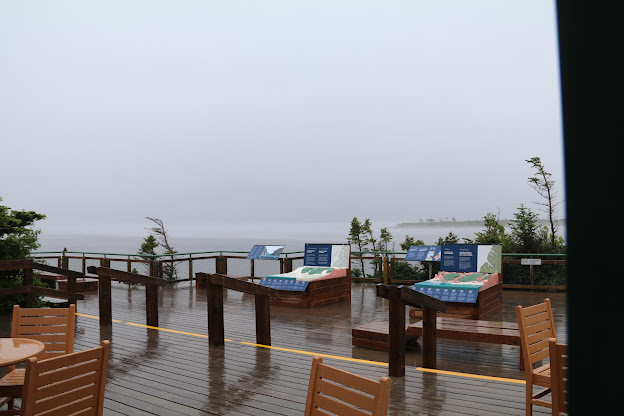
Here is a photo we took from the tour office showing how foggy the lake is:


Here is a video of what it was like in the tour office:


As luck would have it later in the afternoon the weather cleared and we took a drive to get some photos. In my home town of Tryon, N.C. we have a mountain named Hogback Mountain. We stopped at a pullout to take a few photos of a mountain here that looks just like the mountain in my home town. I am not very skilled at taking selfies but here is one of Pam and I with that mountain in the background.


Here is a view looking west with the sun reflecting on East Arm:


This photo reminds us of the Smoky Mountains:


We drove back to Rocky Harbor for dinner at a local restaurant and caught the sunset on the harbor driving back to the campground.


On Saturday we left Rocky Harbor and back tracked to reach the Trans Canada Highway and continued on to Gander. We encountered some very strong side winds that gave us pause. We had heard about the winds from a fellow camper who said a semi truck had been blown over a few days ago in the area. We were glad to reach Gander where we found out from the locals that the strong winds were not a normal condition.

Gander is famous for its airport and the town gave refuge to 38 commercial flights and 7000 passengers when the air space in the United States was closed on September 11, 2001. There is a local play about the event but any dates that we would be able to see the show were sold out. We did visit the North Atlantic Aviation Museum where we discovered that construction of the airport began in 1936 by the British and the first plane landed here in 1938. Newfoundland was a British colony until March 1949 when it became the 10th province of Canada. An airport in Gander was advantageous because of its proximity to Ireland and the United Kingdom. We forget that transatlantic flight was not always a causal undertaking like it is today. During World War II the Gander airport was a strategic military resource for transporting planes to the war effort in Europe and during the course of the war about 10,000 planes were flown from Gander to Europe.


 Of course my personality was drawn to the display of the Rolls Royce Merlin, 27 liter, V12 engine that powered famous WWII aircraft like the Spitfire.


But the display that got me real excited was a mock DC-3 cockpit complete with sound and video. Here is a short video of the display on youTube. The video was to large for a direct insert to this blog.


https://www.youtube.com/watch?v=wtIX96meXbo


Wednesday, June 18, 2025

 The sign we see as we depart the ferry terminal:


On our first day here we drove up the coast to a fish processing facility where we were told we would be able to purchase freshly caught fish. That turned out not to be the case. When we were there they only had lobster. We are not lobster fans. We assume they did have a catch of the day because we saw trucks being loaded. Probably already spoken for by retailers on the island.

The drive did result in some nice scenery and an old church nearby. Here is a panoramic view of Codroy Valley:


The Anglican Church:


View from the church:


Yesterday we drove the Granite Coast from Port aux Basques out to Rose Blanche and the Rose Blanche Lighthouse at the terminus. We looked up how to pronounce Port aux Basques and in English it is pronounced Port oh Basks. The coast road gets it's name because the coast line is granite. We are amazed they very able to build a road to Rose Blanche and they did not until 1961. Prior to that the only access to Rose Blanche was by sea. A sign at the light house reveals that the name Rose Blanche is derived from the French words for white rock, roche blanche. The shoreline of white rock was visible to the French fisherman when they first approached the shore in the early 1700s. Rose Blanche did not have electricity until 1965. The population peaked in the late 1970s but has been in decline since due to the cod moratorium that caused the collapse of the fishing industry in the 1990s. We spoke to a man at the lighthouse who has lived in Rose Blanche for 65 years. He started his career as a fisherman and later worked and retired from Marine Atlantic, the company that operates the ferry system out of Port aux Basques. He now is the maintenance man for the lighthouse. 

Our research for the trip indicated there were two cafe's on the road to Rose Blanche but they seemed to be closed. We believe the tourist season does not get in full swing here until July. We had our heart set on lunch at one of these but had to settle for the burger stand at the lighthouse. The burgers were good and the two ladies who ran it were fun to converse with. For those who are not familiar with the Canadian monetary system, they do not have pennies and round every transaction to the nearest nickel. They have a $2 coin as well as a $1 coin called the looney. They also have a quarter, a dime, and a nickel. My left side was starting to get heavy because of $11.35 in change. Our bill was $30.25 and we ask the lady if we could unload some of that change. She was elated and welcomed the $10.25 in change.

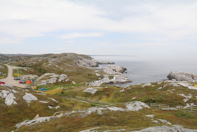
White rock along the shore:


Rose Blanche Harbor:


The trail to the lighthouse:


The lighthouse at a distance:


The lighthouse up close:


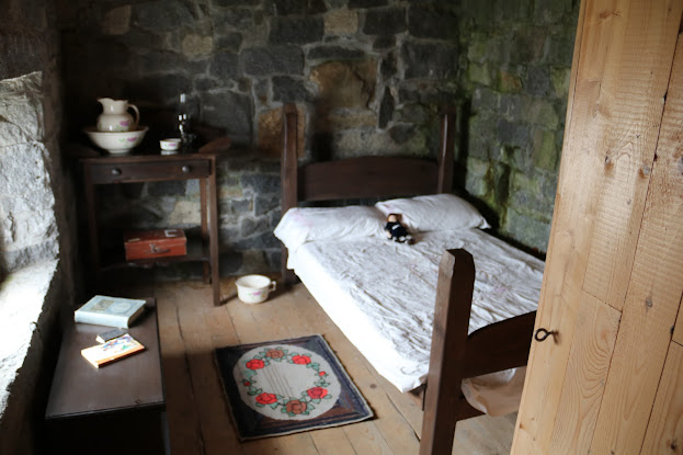
The lighthouse is constructed of stone. Notice the walls in the photo below:


We thought the spiral stair case constructed of stone was interesting;


There was a notable author from Rose Blanche by the name of Cassie Brown. Below is a Google link to her:

https://tinyurl.com/2xhuwofp

Today we explored the local area again and stopped at a small country grocery store just to see what it was like. We ended up buying a bunch of bananas for $4.95 Canadian. That is about $3.61 in US dollars and more than double what we would pay for the same bananas at home.

One site we were interested in was the Precious Blood Roman Catholic Church located at the coordinates 47.777812, -59.27305.

https://www.heritage.nf.ca/articles/society/precious-blood-church.php

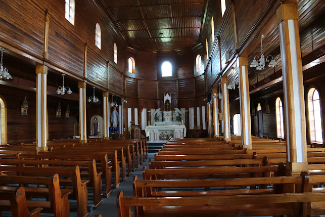
When we pulled up to the church there was an older gentleman working from the trunk area of a late  model Jeep (relative comment since I will be 79 in 11 days and he was actual 72) attempting to re-string a string trimmer. We told him we were just tourist and wanted to take some photos of the church. He replied that he was also a tourist from Ontario and elaborated on that to reveal that he was born here and married in the church 54 years ago at the age of 18. That is how we came up with his age. He moved to Ontario a year later at the age of 19. He is now retired and has a summer home here and told us the church was unlocked and we were welcome to go inside. He actually took us inside and gave us a short tour. He showed us the organ that his mother played in the church for 50 years and ask that we sign the visitor register. He explained that because the church is now a Registered Heritage Structure they can no longer make upgrades or modifications. His tour was free but we did put a little something in the donation box.

The church:


Inside:


The organ his mother played for 50 years. The picture in the frame is his mother.


After we got back to the campground we decided to walk a trail on the property. Here is Pam negotiating the trail.


First Baptist Church of Amherst, Nova Scotia

 This will be the final post to this blog for this trip. We are headed home. Marine Atlantic ferries to and from Newfoundland cross either a...